Elena Wolf · 2 September 2026
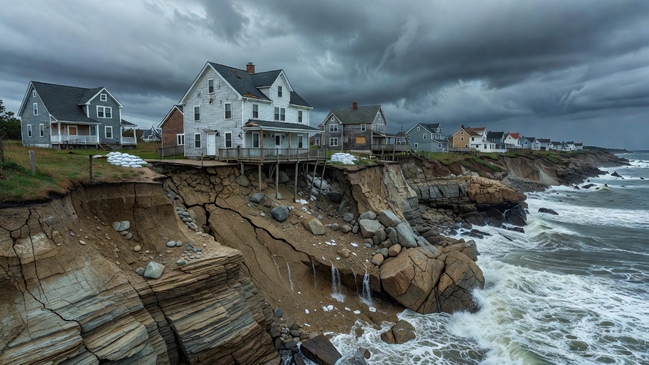
The coastal areas of Maine are experiencing accelerated erosion that poses significant risks to homes situated on cliff tops. Recent studies indicate that sea level rise combined with increased storm intensity is wearing away at the rocky shores at rates up to several feet per year in vulnerable spots. Residents in towns like Wells and Kennebunkport have reported property damage as cliffs recede closer to their foundations. Experts warn that without intervention, dozens of properties could be lost within the next decade. The threat is not uniform across the state with southern Maine seeing faster rates due to softer sediments compared to the granite dominated north. Property values have begun to decline in affected areas as buyers become aware of the risks involved in cliff top living.
The Geological Factors at Play
Maine's cliffs are composed primarily of sedimentary rock and glacial till which are susceptible to wave action and freeze-thaw cycles. As ocean temperatures rise, the frequency of nor'easters has increased, leading to more powerful waves that undercut the base of the cliffs. This process, known as coastal bluff erosion, has been documented by the Maine Geological Survey showing average annual losses of 0.5 to 2 feet in many areas. Vegetation removal for development has also contributed by reducing natural stabilization. Historical records show that erosion has been ongoing but the pace has quickened since the 1990s. Scientists attribute this to anthropogenic climate change effects on weather patterns.
Responses from Homeowners and Officials
Local governments are implementing measures such as seawalls and beach nourishment projects to combat the erosion. Some homeowners are opting for managed retreat, selling properties and relocating inland. Insurance companies are raising premiums or denying coverage for high-risk zones, prompting calls for state-funded protection programs. Environmental groups advocate for preserving natural buffers like dunes and wetlands instead of hard engineering solutions. Community meetings have been held to discuss zoning changes that limit new construction near eroding edges. Data from satellite imagery and LiDAR surveys help monitor changes over time, providing crucial information for planning. Federal grants from FEMA are being sought to fund protective infrastructure. Meanwhile, researchers at the University of Maine are studying native plant species that could help stabilize slopes naturally. Long term strategies may include elevating homes or constructing elevated walkways but these are costly and not always feasible on steep terrains. The situation highlights the broader challenges of climate adaptation in coastal regions worldwide.